
Tosamaidan
Surrounded by thickly wooded forests, Tosa Maidan is situated about 10 kms from Khag in the mountains of the Pir Panjal range. The pristine Tosa Maidan valley has been a tourist attraction for last so many years. Due to its gorgeous landscape and pleasantly cool breeze during the summers, visitors throng the place in hordes. After crossing the upper mountain reaches of Drang, Zakhora and some small villages, one reaches the pasture of Tosa Maidan. From here, a path also leads to Nilnag where a fabulous lake is located which is edged by tall pine trees. Tosa Maidan is the largest pasture in the area; 3 miles in length and 1.5 miles in width. Sky-touching deodars fence this pasture, presenting a view of a green carpet in summers. During the summer, the camping of the Gujjar community and shepherds with their flocks of sheep in the pasture present a riveting picture. This captivating place is not only famous as a pasture but also for its historical background. The Mughals used to go to Poonch using this route. It is said that they had constructed a seven-storey building (Dam-Dam) here as well. The Basmai Gali(13,000 ft) is the pass which leads into Tosa Maidan. Another pass - Poonch Gali - on its right side leads to the valley of Poonch. This pass was deemed to be the safest, easiest, and nearest to reach Punjab in ancient times. It is enroute a major trekking route from Yousmarg that leads to this famous spot and proceeds ahead. Tosa Maidan has plenty of snow capped mountains forming its frame. Also, there is a wide range of wild flowers bedecking the landscape. The fragrance of wild flowers refreshes the whole environment, casting a unique spell upon the visitors. The region is full of springs; the one in its vicinity at Khag is most famous for the curative properties of its waters. One can either trek the distance from Yousmarg or catch a Sumo jeep from Srinagar. The area is connected through roads to places like Gulmarg and Poonch. The best time to visit this tranquil pasture is between May and September. For rest of the months, the valley experiences heavy snowfall and all the connecting links are severed.
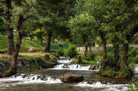
Aharbal
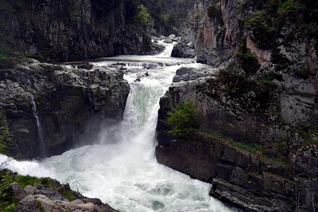
Traversing the pine- covered mountains of Pir Panjal range, the boisterous waters of Vishav river tumble down straight 25 metres below at Aharbal creating a waterfall. This famous waterfall is located in the south western part of the valley in Kulgam district, some 75 kilometres from Srinagar at an altitude of 2266 metres above sea level. The sheer volume of water that comes crashing down on the rocks below is enough to make its roar audible from a distance. The serenity all around pronounces the sound of waterfall to deafening decibels as one nears it. Of late arrangements have been made for visitors to make it up to the edge of the fall, thus infusing adventure into the sightseeing of Aharbal waterfall. It is also referred to as the Niagara Falls of Kashmir, owing to the volume of the water that falls down. The source of the water lies deep in the pine and fir forests in the form of gorgeous Kounsarnag Lake (13,500 ft above sea level). Aharbal acts as the starting point for trek to Kousarnag Lake which passes through stunningly beautiful elevated valleys and meadows. All along the way wild flowers, gigantic alpine trees, roaring waters of Vishav and myriad wildlife invigorates the trekker. Famous for its scenic beauty, Aharbal has become a well known picnic spot for school children and the locals who throng the place when plain areas witness sweltering temperatures. The scenic meadow of Kungwatan lies at the halfway point of the two-day trek to the high-altitude Konsarnag Lake. Surrounded on all sides by dense canopy of verdant alpine trees, the meadow is a calm and tranquil place, mostly inhabited during summers by the cattle herders. One can even enjoy angling in the Vishav river as it teems with trout fish, introduced into it by the Fisheries department. All it needs is just a fishing permit which can be obtained from the Fisheries department stationed at Aharbal.
Daksum
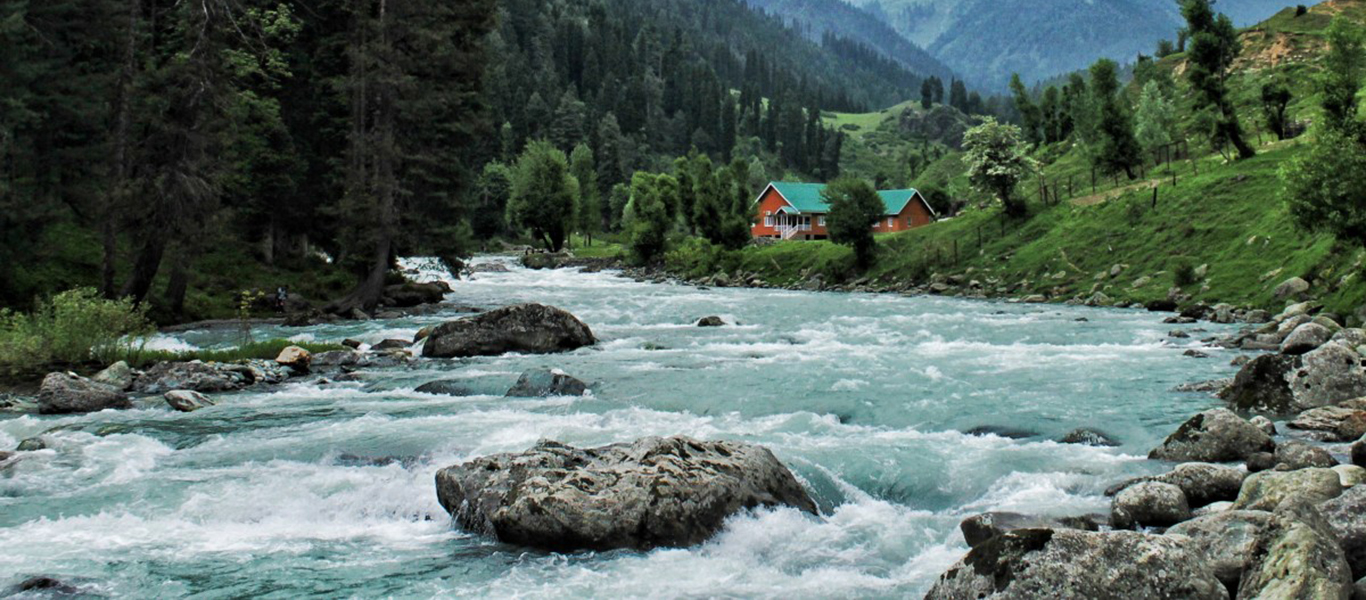
A scenic picnic spot, Daksum lies 14 km south east of Kokernag at an altitude of 2438 m (8,099ft) above sea level on the Anantnag- Kishtwar highway. The picturesque Daksum, situated in a densely forested gorge, presents an awe-inspiring sight with ubiquitous peace and tranquility. The only sound heard there is that of the Bringi River, rushing right through its center. Daksum in Kashmir valley is a must for those fond of walking and nature as a number of treks branch out from this fascinating place. A walk in Daksum will take you up to the hills enveloped in lush coniferous trees and past gurgling brooks. The simple music coming out of the flute of an unseen shepherd tending to his flock will keep you mesmerized The landscape of Daksum is quite unique. From the tree-covered hills, you will suddenly find yourself in grassy meadows serving as host to the sheep coming for pasture. The invigorating mountain air, the calm and serenity, the densely clad hills, all make the trip to Daksum a memorable experience. Then, there are the snow-capped mountains in the background that further enhance the beauty of this place. The trek to the gorgeous Sinthan top meanders its trail through some pristine and virgin meadows and valleys. You will be crossing dashing Bringi River many times with every crossing opening to a new and better treasure of natural beauty.
Margan Top
Perched at an altitude of 14,000 ft, the Margan Top has of late become a tourist attraction for being one of the most beautiful mountain tops of the Himalayan region in south Kashmir. Situated at about 35 km from Kokernag, this mountain pass is the gate way to a hidden valley called Warwan. Surrounded by beautiful meadows all around, the Margan Top boasts of a 360 degree view with Kashmir valley on one side and the Warwan valley on the other. Its name is derived from two words; Mar meaning death and Gan connoting valley. For its unpredictable weather conditions, it had been a valley of death till a road was constructed just ten years ago. Margan Top is studded with four magnificent small lakes, together called Choharnag or four lakes. Lying at a distance of 3 km from the main road, these high altitude lakes provide a soul-soothing ambience at top of the mountain. The surrounding meadows of the Margan Top present a riot of colours during the summers when the wild flowers blossom in unison. The long and grassy expanses are home to thousands of sheep and goats who are brought here by Gujjars and Bakerwal tribesmen to graze here for some months.
Mughal Road, Peer Ki Gali, Aliabad
Mughal Road is the road between Bafliaz, a town in the Poonch district, to Shopian district in the Kashmir valley. The road is 84 km long. It passes over Pir Panjal Mountain range at an altitude of 11,500 ft (3505 m) that is higher than Banihal pass (2832 m).The road brings the Poonch and Rajouri districts closer to Srinagar in Kashmir valley and reduces the distance between Srinagar and Poonch from 588km to 126km. It makes an alternate road connectivity to Kashmir valley with rest of the country, an alternate to the over-crowded Jammu-Srinagar Highway through Jawahar Tunnel (Banihal Tunnel) in National Highway 1A. The road passes through Buffliaz, Behramgalla, Chandimarh,Poshana, Chattapani, Peer Ki Gali, Aliabad, Zaznar, Dubjan, Heerpora and Shopian.The road was historically used by Mughal emperors to travel and conquer Kashmir during the sixteenth century. It was the route used by Akbar the Great to conquer Kashmir in 1586 and his son Emperor Jahangir died while returning from Kashmir on this road near Rajouri.
PEER KI GALI
Peer ki Gali is a religious spot named because of a converted Hindu saint (Seikh Ahmed Karim). Bernier Francios a most famous Francis visitor who happened to pass this place along with caravan of Mughal emperor Auranzab while going to Kashmir from Lahore in 1665 writes that this saint was living here from the time of king Jhanjir. This saint could perform miracles by producing horrible voices. He could also bring storms along with hail stones and snow. He was an old white bearded man who ordered the people not to create noise in this calm place of God and also demand offerings from them. It seems that peer used to tell that Mughal king Auranzab and Shah Jahan were wise enough as they passed this calm place of God very calmly unlike Jahangir. As a result, Jahangir faced dangerous results during his time of rule.
ALIABAD SARAI.
Few kilometres away from Peer ki Gali is situated another Mughal fort named as Aliabad Sarai. This fort was constructed by Mughal king Shah Jahan. It is a beautiful example of art created by artists of Mughal empire. As per the written records Ali Mardan Khan was a Mughal constructor and he had constructed all the forts and routes along Mughal road. There are some interesting stories around a secret routes created around Aliabad Sarai. A lot of green meadows around Mughal Road are full of cattle grazing and enjoying sunshine. Daubjan is another such beautiful and attractive meadow. Daubjan is followed by Heerpur. Roads and meadows around Heerpur will make you float in heavenly atmosphere of Kashmir and probably that's why Kashmir is known as heaven on Earth.
Shrine Of Baba Shakur Ud Din
A Sufi shrine situated at a hillock near Watlab Sopore in the name of Baba Shukur ud din who was one of the the four disciples of sufi saint Nundreshi. Baba is known for his assistance and many miracles performed by him and earned popularity among the local populous. It is said that baba Shukur-ud-din dug a grave for himself and stepped into it. Lakhs of worshippers visit his Ziarat for pilgrimage and to pay homage to the great saint who did not discrimnate between hindus and muslims. The peer baba is also known as Topandaz-e-kashmir and is locally believed to neutralize evils, for well being of people of Kashmir. 27th of Islamic Calendar Month Jamadi-Us-Sani is celebrated the Urs of Baba Shakur-Ud-Din Wali
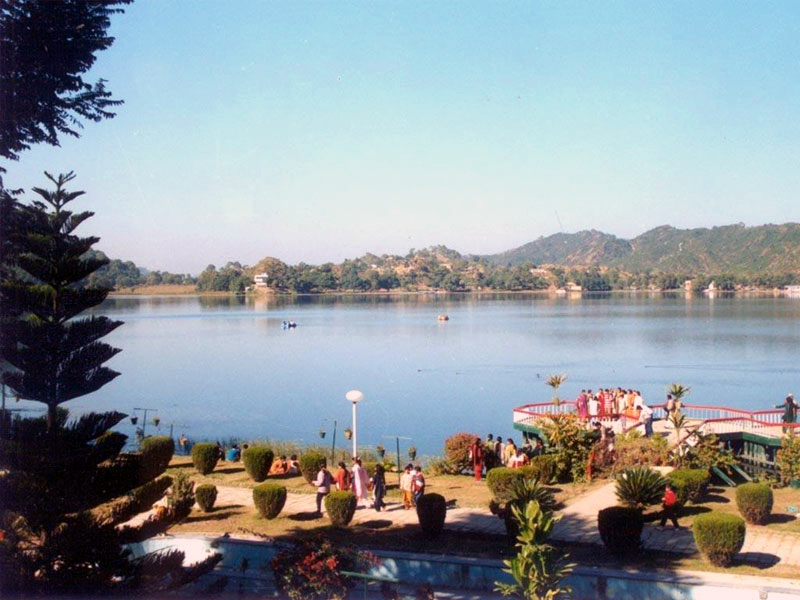
Mansar
Mansar is situated 64 kms from Jammu off the Jammu-Pathankot Highway. It’s a very picturesque lake with pine forested hills surrounding it on all sides. About a mile in length by half a mile in width the waters are crystal clear and very popular for boating. A peculiar feature of the lake is the presence of a large number of huge turtles in the lake. Besides, being a popular excursion destination in Jammu, it is also a holy site, sharing the legend and sanctity of Lake Mansarovar. There are several temples located on the periphery of the Lake. On the eastern bank of Mansar Lake there is a shrine dedicated to Sheshnag, a mythological snake with six heads. The shrine comprises a big boulder on which are placed a number of iron chains perhaps representing the small serpents waiting on the tutelary deity of the Sheshnag. Newlywed couples consider it auspicious to perform three circumambulations (Parikarma) around the lake to seek the blessings of Lord Sheshnag.

Patnitop
Patnitop is located in the Lower Himalayan Range close to the Pir Panjal range, 47 km from Udhampur and 112 km from Jammu.This famous hill resort is perched on a beautiful plateau, at an altitude of 2024 m across which the Jammu-Srinagar Highway passes. The towns of Kud and Batote are nearby. Kud is a very small town where sweet shops make fresh Patissa (a sweet). It may be bought hot and melts in one's mouth. Batote is known as a place for quality rajma or the kidney bean.
NEARBY PLACES
GOURIKUND
This is the pilgimage site connected to Devi Parvati, the goddess.
SUDH MAHADEV MANDIR
Believed to be 2800 years old, the temple of Sudh Mahadev houses a natural black marble Lingam, the Trident of Lord Shiva.
SHIVGARH
The Lush Wooded Pine Forest In Patnitop Offers Ample Opportunity For Trekking. This Place Acts As A Good Starting Point.
UDHAMPUR
Udhampur is a district in the UT of Jammu and Kashmir. Udhampur town is the headquarters of this district.
PINE FOREST
Pine forests offers beautiful picnic spots, peaceful walks and breathtaking views of the mountainscape of the Chenab basin.
ENGRAVED STAIRS
Approx 400 plus steps have been carved out along the rock face to make the steep slope negotiable.

Jammu City
Jammu - the Duggar land where the past still has a living presence. A land of grand ancient temples, and beautiful palaces. Nestled against the backdrop of the snow-capped Pir Panjal Mountains, the region of Jammu constitutes the southernmost unit of the UT of Jammu & Kashmir. It forms part of the transition between the Himalayan range in the north and the dusty plains of Punjab in the south. Between these two extremities lie a series of scrub-covered hills, forested mountain ranges and river valleys, encompassing several microclimatic regions that extend from Kishtawar in the north-east to Akhnoor in the south-west, and the historic town of Poonch in the north-west to the borders of Kangra (H P) in the south-east. The Shivalik hills cut across the area from the east to the west while the rivers Ravi, Tawi and Chenab cut their way through the region. The last stop on the railway line north is Udhampur, where you can catch onward buses and hire SUVs/MUVs (Tata Sumo / Toyota Innova/ Mahindra Scorpio). However it is better to get down in Jammu and catch a taxi from there as these are more readily available.
KATRA
The journey to the Holy Shrine of Shri Mata Vaishno Devi Ji starts with the Call of Mata. It is not only a belief but also a strong experience of one and all that the Divine Mother sends a call to her children. And once a person receives it, wherever he/she is, they are bound to visit the Mother to receive Her unbounded love and blessings. A popular slogan in the local folklore beautifully expresses it- Maan Aap Bulandi - which means that The Mother Herself Calls! It is also a matter of experience by almost all those who visit the Holy Shrine that upon the Call of Mata, a person needs to just take one step and leave the rest to Her and his journey gets completed with Her divine blessings. Simultaneously, it is also believed that unless there is a call or Bulawa no one can visit the Shrine or have Her blessings, howsoever high or mighty one may be.
NEAR BY PLACES
MATA VAISHNO DEVI
The Holy Shrine of Mata Vaishno Devi is an enchanting journey where Mata Vaishnavi had spent some time.
CHARAN PADUKA
The place where the imprints of Mata's pious feet are believed to be imprinted on a rock slab.
DARSHAN DWAR
The entry gate to the track is around 1 km from the bus stand at a point known as Darshani Deodhi (meaning entrance) or Darshani Darwaza.
BAN GANGA
After the Police Check Post and Yatra Parchi Check Post, the pilgrims reach a small bridge under which flows Banganga, the legendary river.
BHAIRO MANDIR
The Bhairon Temple remained ignored prior to take over of the holy Shrine by Shri Mata Vaishno Devi Shrine Board in the year 1986.
SANJHI CHHAT HELIPAD
Helicopters fly to Sanjhi Chhat Helipad for Vaishno Devi Temple.
KATRA CITY
Katra Town, lying in the foot of Trikuta Mountains, 48 kms. from Jammu.
TRIKUTA PARVAT
It is situated 10 km away from Deoghar on the way to Dumka. There are three main peaks on the hill which is why it is called Trikutachal.
GEETA MANDIR
After Banganga, the devotees come across towards beautiful temple Shree Geeta Bhawan which is extremely beautiful and worth watching.
BEST TIME TO VISIT
Throughout the year.

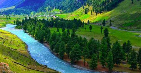
Lolab Valley
Lolab valley, locally known as ‘Wadi-e-Lolab’ is known for its fruit orchards, lake, springs and lush rice fields. Lolab can be easily reached by road. Travelers staying in Srinagar can easily reach Lolab by a local bus or hire a taxi. Poets like to refer to Lolab as a true destination and as “land of love and beauty”. Lolab valley is 5km wide and 26 km long. It is located at a distance of 120 kms from Srinagar in Kupwara district. Lolab is a combination of three valleys, Potnai valley, Brunai valley and Kalaroos valley. There are beautiful Nagmarg meadows, which separate Lolab from Bandipora district.The headquarters of Lolab is situated at Sogam. It is said that Sogam was very densely populated a long time ago, when Kashmir valley was still a lake called “Satisar”. Travelers visiting Lolab also visit the resting place of a famous saint Kashyap reshi, which is located at a distance of 1 km from village Lalpur. A spring called Lavnag can be found nearby. The spring is three feet deep and has crystal clear water. Gauri spring is another major spring in the area. Government has taken several steps to maintain Lolab Valley to its pristine beauty. Lolab valley is in the northern district of Kupwara of the UT of Jammu and Kashmir. Being very close to India’s most disputed border, Kupwara unfortunately ignites a lot of fear. But things are changing now. Lolab valley is studded with natural beauty and warm, hospitable locals minus the throngs of tourists. This part of Kashmir is as virgin as it gets.The Lolab Valley is a Himalayan sub-valley and forms the north-western corner of the Kashmir Valley formed by the Lahwal River in the disputed territory of Jammu and Kashmir. The entrance to the valley lies 9 km (5.6 mi) north of Kupwara town and the centre of the valley lies 114 km (71 mi) northwest of Srinagar, the capital of Jammu and Kashmir. It is an oval-shaped valley 15 miles (24 km) long with an average width of 2 miles (3.2 km). The Lolab Valley is situated within the jurisdiction of Sogam, a block of Kupwara. It is bordered by the Kashmir Valley to the south and the Neelum Valley to the north, and is separated by Nagmarg meadows from Bandipore to the east. It is formed by the flow of Lahwal River, which flows from east to west. The Lolab Valley is home to many ancient springs, and is covered with dense forests of pine and fir. Fruit trees such as apple, cherry, peach, apricot and walnut are common in the valley, which is known as "the fruit bowl of Jammu and Kashmir". The valley has several natural landmarks and tourist spots, such as the caves of Kalaroos. The main towns in the Lolab Valley are Sogam, Kalaroos, Kigam, Lalpor, Tekipora, Chandigam, Kandi and Muqam. The Lolab Valley has two division POUTNAI and BRUNAI, the areas included in POUTNAI are chandigam, etc. In BRUNAI are kuligam, cheepora, varnow, etc. Like other valleys in the region, Lolab Valley is also home to many Himalayan wild animals, which include Himalayan black bear, Himalayan brown bear, snow leopard, ibex, markhor, hangul and musk deer.[6][citation needed] Lolab Vally is adjacent to Neelum Valley, and separated by the Line of Control.The Valley has seen many armed combats which has resulted in the displacement of many wild animals.
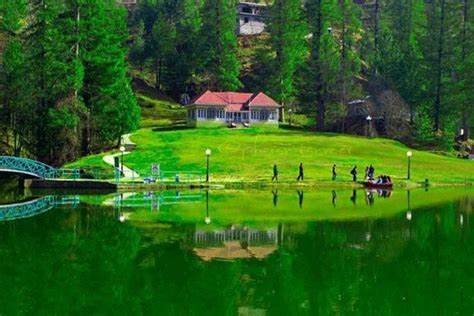
Kokernag
Kokernag is a blend of all delicate components of natural beauty that attracts tourists from all over the world. Home to a spring with magical, curative powers, a tour to Kokernag is one of the most popular weekend getaways from Srinagar. Located at an altitude of around 2012 meters above sea level, tour to Kokernag also reveals some of the other treasures of this important tourist destination. The moment you enter the green valley of Kokernag, you are welcomed by the cool and fragrant air of the mountains, an air that brings with it the perfume of the blossoming flowers which you see all around this picturesque vale. An array of springs gush out of the base of a thickly wooded hill from where the waters divide into channels, resembling to the claw- foot of a hen, hence its name; Kokernag. Place is famous for gardens, largest fresh water springs and its trout stocked streams. Kokernag has been a famous place from mediaeval times and is mentioned in Ain Akbari that the water of Kokernag satisfies both hunger and thirst and it is also a remedy for indigestion. It is also famous for its trout streams. Trout hatchery department has constructed pools in series where in trout is reared. Different pools have got trout with different weights and ages. Kokernag is situated at a distance of about 22 km from Anantnag on the right side of Anantnag- Kishtwar highway. The easiest and most comfortable way of reaching this place is to hire a Sumo at Anantnag. One can also catch a local bus that is easily available in Anantnag and head towards Kokernag. It takes about one hour to reach Kokernag. Blessed with rich soil which promotes the growth of several varieties of plants and flowers, a tour to Kokernag is made even more perfect by the presence of a number of accommodation options in the region. The total area of Kokernag is 300 Kanals of which 129 kanals is for the purpose of gardens and the rest is forest area. Many fascinating destinations are found in this area including Daksum, Sinthan Top, Margan Top, Botanical Garden, Trout Fish Hatchery and Achabal.
INTERESTING FACTS
One of the tourist attractions around famous Kokernag spring is Trout Fish Hatchery with its channels stocked with fishes of different sizes and ages. Introduced in early 1980’s, the trout here has increased in number and the export capability of the Hatchery was achieved in 2009 when fish seeds were exported to north east and Bhutan from here. Located just nearby to th Kokernag, the waters of the Kokernag spring are fed to numerous channels where trout fishes of many varieties are reared. The Hatchery is used for breeding and a high quality seed is produced here. This seed is further distributed to the J&K Fisheries departmental rearing units all over the UT and to the private fish farmers. This quality seed is also used for stocking in all the water bodies of the UT.
The Hatchery is surrounded on its western side by a hill covered with dense forests and consigning the place a spectacular look. There is a garden as well and it is bedecked with variety of flowers that add to the charm of the place. The water channels are interspersed with long patches of grassy beds dotted with willow trees, providing shade to the extremely sensitive trout fishes during summers besides increasing the fascination of the ambience.
Owing to successful, introduction and subsequent establishment of trout in the valley of Kashmir in 1900 AD, the Department of Fisheries was created in 1903 AD and re-organized in 1978. Trout Fisheries in the UT received a major thrust during the last two decades with the establishment of Mother Trout Fish Farming Project at Kokernag under European Union Assistance. Here quality Trout seed of Rainbow Trout and Brown Trout is being produced. Trout culture is under taken under modern technology of breeding and rearing to ensure better survival at different stages of the fish. Moreover, a highly equipped Trout feed mill imported from Holland is also housed in this Hatchery. A visitor will enjoy the serene environs of Trout hatchery as well as the trout fishes in their natural environment simultaneously.
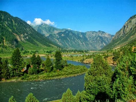
Warwan Valley
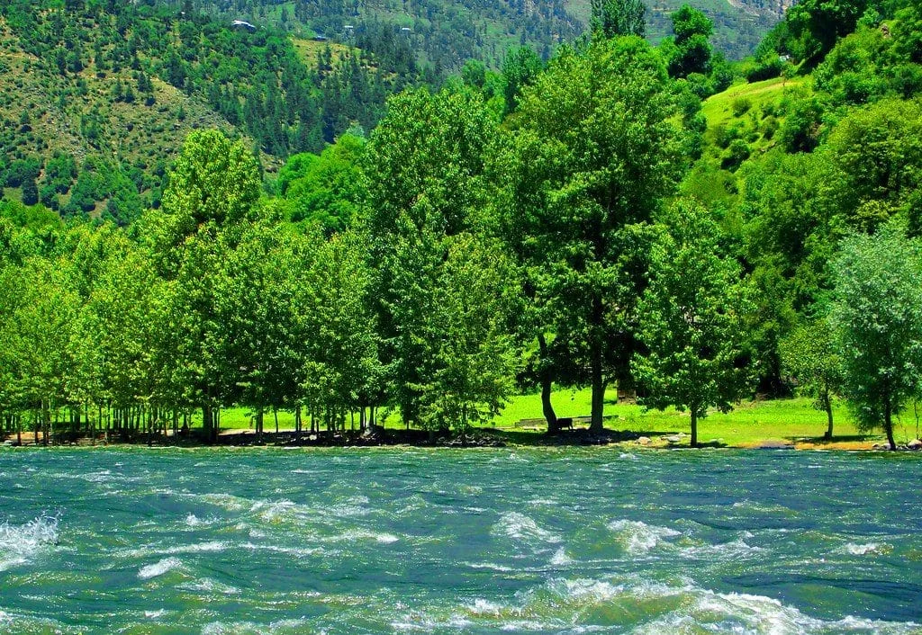
Warwan Valley with an average elevation of more than 85,00 ft above the sea level is a hidden treasure of natural beauty. Its starting point, Inshan village, lies some 50 km south of Anantnag. This pristine valley comprises 13 villages with three located on left bank of the Warwan river and 10 on its right side. Warwan Valley is a gorgeously beautiful long but narrow valley with width not exceeding 3 km. This 30 km long valley has splendid waterfalls, vast verdant meadows and pastures, huge cedar trees, enormous patches of thickly wooded forests and all sorts of natural scenic places that leave the visitor spell bound. Continuous caresses of the cool breeze soothe the soul of the travelers who walk across it to explore its interiors. Sandwiched between Kashmir and Ladakh region of the UT, this valley is connected to Zanaskar valley of Ladakh region through a mountain pass called Kanital pass. Kanital glacier is among the big glaciers of the UT. It is located at an elevation of 13,500 ft above the sea level, some 20 kilometers from the last Warwan village of Sukhnai. This glacier is the source of Warwan river which is one of the tributaries of Chenab River. Across the Kanital mountain lies Panikhar in Zanskar region, which is a day’s trek away. The Warwan Valley has its own flora and fauna. Even the crops are different from that of Kashmir or Ladakh. Having remained untouched for generations, the valley is pollution free and offers natural beauty at every curve and curl.
Gurez
A trip to Gurez Valley is an unforgettable experience. Located at an attitude of 8,000 feet (2,400 m), the place is a real treat for visitors as you get to see real village life – people still living in log and wooden houses.The stream flowing from Kishan Ganga River and a must-watch Habba Khatoon peak will only help you relieve your mind of the noisy city and its hustle and bustle.To attract tourists, tourism department is organizing festival in July. Gurez Valley is at a distance of 123 kilometers from Srinagar and 86 kilometers from the Bandipore district in North Kashmir. From Srinagar, the trip to this picturesque valley in a cab takes 6 to 7 hours. Given the nature of curvy roads carved out of mountains, mostly private transport plies on the route to Gurez. The journey is a treat with pine trees on both sides of the road refreshing visitors with its cool breeze. The simple music coming out of the flute of an unseen shepherd tending to his flock will keep you mesmerized. After enjoying a travel of 46 kilometers from Bandipore town, the Razdan Pass, which boasts of rolling meadows, welcomes you. Spending some time at this pass makes one to forget everything for a moment. The pass crosses through highest meadow in the journey and is a perfect picnic spot with tall pine trees rising majestically on the ridges. Several acres of rolling meadows on the top seem to be touching the sky while on a rainy day the clouds embrace the place. The forward journey form Razdan Pass is down-slope and an entry into Diwar village of Gurez Valley. Diwar is a plain area surrounded by mountains from all four sides. In the middle of this plane, Habba Khatoon peak will catch your eyes. It is around this peak that Habba Khatoon used to room around thus named after her. The Diwar village will let you see the real Kashmir as the people especially women still wear traditional Kashmiri dress, houses are wooden mostly erected from big logs and most households have cattle.The Kishan Ganga River flows through the village and is amicable for rafting. The visitors can stay for night also as Tourism Department has constructed beautiful Dak Banglow and Tourist Reception Centre building on the foothills. Gurez Valley has its own market where few hotels have also come up.
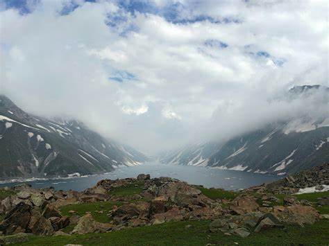
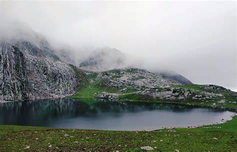
Kounsar Nag, Walur Lake
Kausar Nag or Kausarnag (sometimes alternatively spelled as Konsarnag), is a high-altitude oligotrophic lake located in the Pir Panjal Range in the Kulgam District's of Jammu and Kashmir. The lake is roughly 2 miles long and half a mile at the widest point. The trek to Kausarnag is via the famous waterfall of Aharbal. The lake is located in a valley that is surrounded by peaks on all sides with elevation in excess of 4000 metres above sea level. Kausar Nag has an elevation of 4,000 metres (13,000 ft) above sea level.
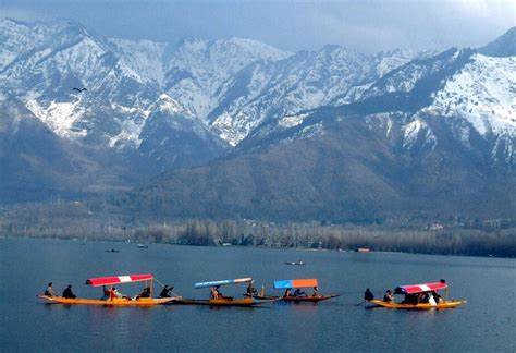
WULAR LAKE
Wular Lake is one of the largest fresh water lakes in Asia. It is situated in Bandipora/Baramulla district in the UT Jammu and Kashmir. The lake basin was formed as a result of tectonic activity and is fed by the Jhelum River. The lake's size varies seasonally from 12 to 100 square miles (30 to 260 square kilometers). The lake, with its big dimensions and the extent of water, gives rise to high leaping waves in the afternoons, called Ullola in Sanskrit, meaning "stormy leaping, high rising waves". Therefore, it was also being called Ullola.. The origin may also be attributed to a Kashmiri word 'Wul', which means a gap or a fissure, appellation that must have come also during this period. The lake is one of the 26 Indian wetlands designated as a Ramsar site.
Wular Lake is an important fish habitat, the main species being the common carp. Fish from Wular Lake make up a significant part of the diet for many thousands of people living on its shores and elsewhere in the Kashmir Valley. Harvesting of water chestnut is also an attraction in wullar lake.
The lake sustains a rich population of birds. Terrestrial birds observed around the lake include the black-eared kite, Eurasian sparrowhawk, short-toed eagle, Himalayan golden eagle, Himalayan monal, chukar partridge, koklass pheasant, rock dove, common cuckoo, alpine swift, Indian roller, Himalayan woodpecker, hoopoe, barn swallow, golden oriole and others. The lake acts as a breeding ground for a large species of migratory birds.Besides the lake is a biotic reserve for a varied number of flora and fauna species.
In order to harness the tourism potential of the area a separate tourism developmental authority by the name “Wullar Manasbal Development Authority” has been created. The authority has developed some scenic points along the circumference of the two lakes of Wullar and Manasbal nowadays hot spots of tourist activities. Few of these include the sufi shrine of Baba shukur-ud-din at watlab and wullar vintage park at Saderkoot Bandipora. One can enjoy shikara rides, bird watching, fishing and related activities in these lakes.

Verinag
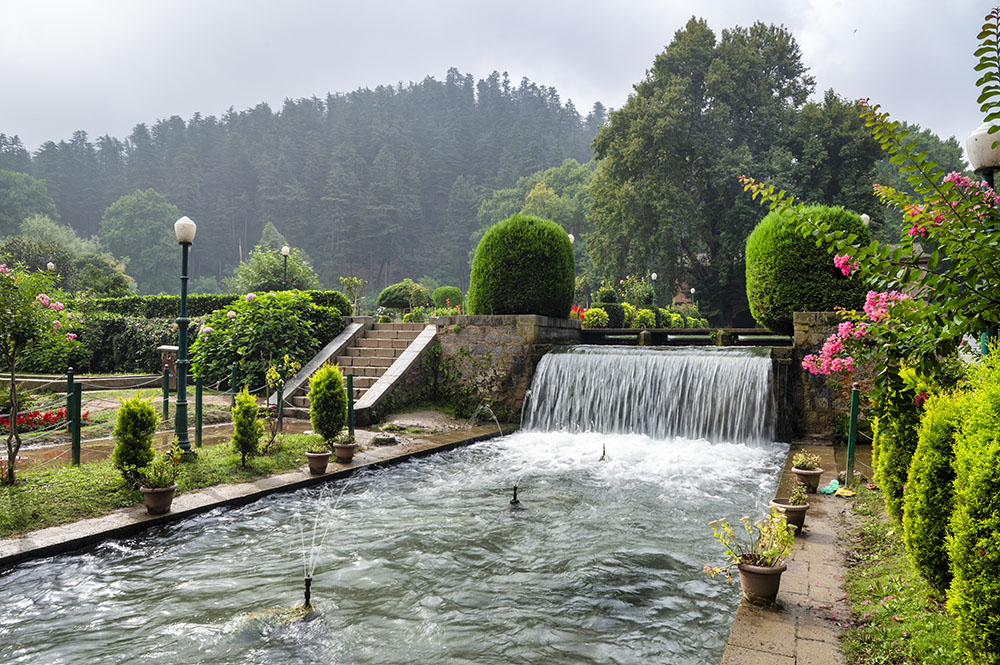
Located at the foothill of picturesque Pir Panjal mountain range, Verinag is a major tourist attraction in south Kashmir’s Anantnag district. It is situated 26 km south of Anantnag and 78 km from Srinagar. It lies just below the entry point of Kashmir Valley after crossing Jawahar Tunnel. With an average elevation of 1,851 m (6,076 ft), Verinag is famous for its spring and a garden. There is an octagonal stone basin at Verinag Spring and an arcade surrounding it which was built by Mughal emperor Jahangir in 1620 A.D. Next to this spring, a beautiful garden was laid out by his son Shah Jahan. This spring is also the major source of river Jhelum that flows through the entire Valley from south to north before crossing over to Pakistan. Verinag spring is situated at the bottom of a hill covered by pine trees and evergreen plants. It was originally an irregular and shapeless pond forming a little marsh. After seeing the dilapidated condition of the spring and its scattered waters, Jahangir’s artistic taste for polishing the beauty of nature could not tolerate the eye- soaring spectacle and he determined to improve it. He built the octagonal tank of sculptured stones round it, so that all water was collected therein, for which carvers were brought from Iran. Seven years later, Shah Jahan, constructed a garden in front of the spring with cascades and aqueducts in straight lines through and around the fine garden.
Sinthantop
Sinthan Top is a less-known tourist spot in the outskirts of Srinagar that is gradually gaining popularity because of its natural beauty.. Sinthan top is a spot 12000 ft above sea level in Kashmir which is midway on the newly opened Anantnag-kokernag-Sinthan-Kishtwar road. The road has been built and is maintained by BRo in excellent condition. It is 132 km from Srinagar.The journey is in itself an experience and once you reach the top it is 360 degree view, and snow everywhere. You can get down from the car and walk on snow. Lying at an elevation of 12000 feet above the sea level, this place overlooks beautiful sceneries of the low-lying regions. The sprawling cover of snow paints this entire area in white, making it visually appealing. During most parts of the year, the area remains inaccessible due to heavy snowfall, and the best time to visit is between April and September.

Naranag
Naranag-Gangabal trek is undoubtedly one of the most beautiful treks in Kashmir region of Jammu & Kashmir state. Gangabal is nestled at the foothill of Mount Haramukh and overwhelmingly one of the most beautiful lakes in the region Naranag is one of the lesser visited places that lies to the north kashmir travelof Srinagar, some 50 kms from it. Naranag is one of the best places, in fact bases for trekking and adventure tours. It lies in the foothills of Pir Panjal range, which extends south east to connect with other popular trekking points. One of the most breathtaking moments are felt higher up where the magnificient Gangabal Lake is present. At the base are the remains of ancient temples built with large granite blocks. The monument looks fascinating with huge rock blocks resting over one another. In the nearby area is a small village. The temple complex is believed to be ancient monuments dedicated to the deity Shiva. Except granite blocks there is no sign of building material, as were used in the latter years. Naranag is also a wonderful camp site. Travelers often carry their tents and other equipment as most of them are interested to go way up. There is a stream that flows besides the monuments, fed by glaciers and the Gangabal Lake situated high up in the mountains. The mountains are uninhabited, except the local tribes called Gujjars who take their cattle to graze on the terraces. The beauty of Naranag lies in the fact that it is desolate, except for the luxuries of nature. As you ascend, there is tranquility and even the murmur of stream vanishes at many places. According to some reports a unique specie like raccoons have been sighted. The trek from Sonamarg to Gangabal, culminating at Naranag is very popular. There are innumerable places which are not lesser in beauty than fantasy lands. Clear water lakes on top of the mountains reflecting perfectly all the shades of blue sky over it is simple magical. If you happen to travel to Naranag, then it would be a mistake not to miss such sites that are located atop the mountains.
Chatpal
Chatpal is a serene, offbeat destination in Kashmir, known for its lush green meadows, dense forests, and clear streams. Ideal for nature lovers and peace seekers, it's perfect for leisurely walks, picnics, and soaking in breathtaking mountain views.
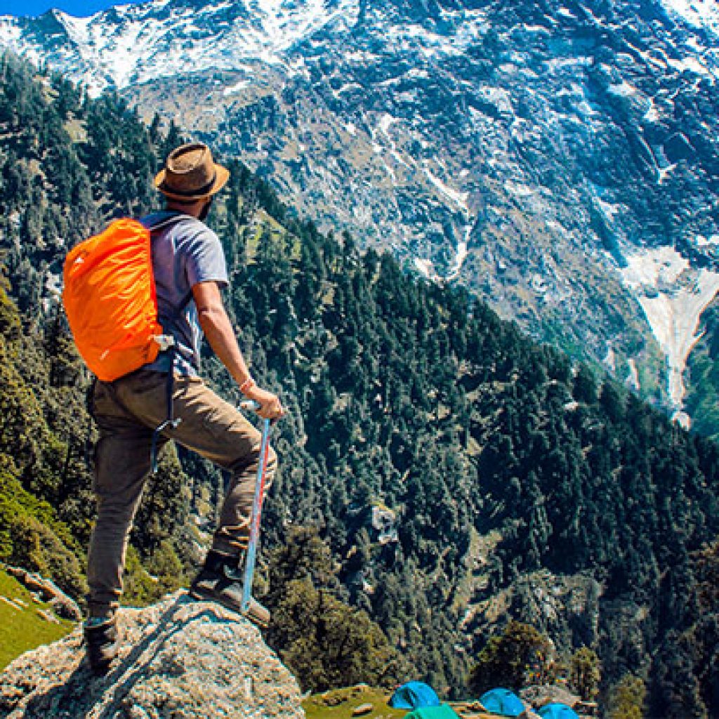
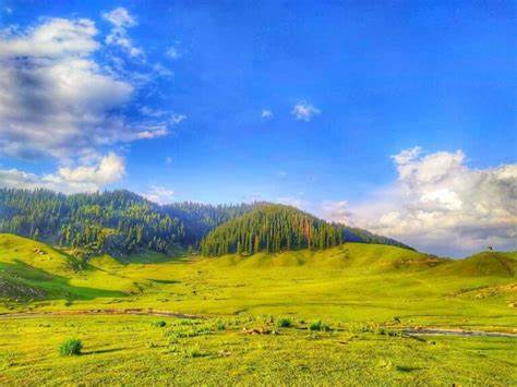
Yousmarg
Yousmarg has the potential to be the gateway to a number of potential destinations in its south, west and east including Doodhpathri, Nilnag, Bargah and Tosamaidan. Yousmarg region has a great tourism potential primarily for the reasons of its virginity and potential for development of ecotourism. The region till some decades ago had abundance of wild life and was famous for the large number of deer that inhabited the region. It is located at a height of 8,900ft from main sea level. The natural slopes of Yousmarg offer skiing opportunities to experts. School camps and adventure lovers make a week to fortnights stay at Yousmarg for the thrilling trekking routes around. Day treks are mostly commenced by the visitors. It is suitable for honeymooners, as it is the quietest place out of all tourist destinations. For the convenience of the tourists, basic amenities such as few huts, public conveniences, kiosks, cafeterias, pony tracks and few parking lots have been constructed here by the Yousmarg Development Authority. Few pony shelters have also been constructed. A tourist information centre also functions at the main bowl. The area being prone to sudden thunderous rains during summers, few facilities of rain shelters have also been provided in the vast area of the resort. So, equipped with all that a visitor wants, this place is fast occupying the slot among top tourist destinations of Kashmir.
Bangus
Bungus, a lush green meadow is situated in the lap of Himalayas, at an altitude of around 10,000 ft. above the sea level. It is 160 kms from Srinagar, and just 48 kms from district headquarter Kupwara. Situated on the other side of Lolab Valley, Bungus valley is about 20 km long and 15 km wide. Pastures of the Bungus valley have finest grass which is considered ideal for cattle grazing, the valley is supposed to have been discovered by a nomad while grazing his cattle in deep forests. Word Bungus is derived from joining two words ‘Bun’ which means forest and ‘Gus’ that means the grass . The valley with rugged terrains and the lush meadows is ideal for the jeep safaris. Bungus is a part of a unique ecological area, comprising mountain and grassland with flora, taiga or coniferous forest. Extreme natural beauty, serenity, splendour are few synonyms associated with the majestic valley of bungus. The valley is surrounded by Rajwar and Mawar in east, Shamsasbury and Dajlungum mountains in the west; Chowkibal, KarnahGali in the north, and Leepa mountains in the south. Bungus is an upcoming destination that will soon see its place in the tourist map of the UT. It is one of the virgin destinations where the avid travelers look forward to visit.
Keran Valley
Keran is a tehsil in Kupwara district, Jammu and Kashmir.It is on the bank of the Kishanganga River. The village lies on the Line of Control. The Keran block includes four panchayats: Keran, Mandian, Mandian-A and Kundian Pathroo. The adjacent habitation on the Pakistani side across the boundary is also called Keran. The Kishanganga river (known by the name Neelum on the other side), flowing through the village, acts as the natural border between the two habitations. While both sides have the same predominant religion, social and cultural practices differ greatly. The people are not allowed by Indian and Pakistani officials to intermingle. Keran village is surrounded by dense forests. Shalabhatu, a village in the Keran sector, is divided between Indian-administered Jammu and Kashmir and Pakistan-administered Kashmir.It was among the foremost infiltration routes used in the early 1990s by militants. The village has three border posts: Khokhri, Kulari and Mangerta. After the reiteration of the ceasefire agreement between India and Pakistan in 2021, the village attracted tourists for the first time, offering a unique view of Pakistan-administered Kashmir. Before this, only the military and locals had access to the village.
Achabal
Achabal known as Achival, is a town in Anantnag district, in the union territory of Jammu and Kashmir, India. Achabal is an important tourist town about 8.1 km away from Anantnag, and is notable for an ancient spring surrounded by a garden terraced and developed by the Mughals. The upper portion of the garden is called 'Bag-e-Begum Abad' developed by Malika Noor Jehan Begum in 1616 AD and renowned as Sahib Abad in which there is a Hamam (treasure of water) getting heat from a logical lamp Cascades and fountains have been erected by Mughal Emperors. A mosque standing in the garden is believed to have been constructed by Mughal Prince Dara Shikwah. Achabal was once the pleasure retreat of Empress Noor Jehan. A trout hatchery is also located nearby. Achabal is the site of a Mughal garden called Achabal Gardens.